Disrupting Fire Pathways

XyloPlan creates a data-driven, shared view of wildfire risk, with actionable solutions that enable Fire Adapted Communities

Fire Pathways™ are the routes formed by the combination of topography, weather, and vegetative fuel that bring wildfire to values-at-risk, including structures and critical infrastructure, during a fast-moving, wind-driven fire event

Types of Fire Pathways™

XyloPlan helps communities increase their wildfire resilience and reduce their risk of wildfire loss by understanding and disrupting Fire Pathways™ with prioritized mitigations.
Vegetation to Vegetation_sq

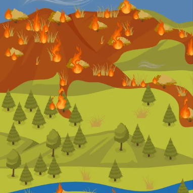
Vegetation-to-Vegetation

Vegetation-to-vegetation Fire Pathways™ are the fastest routes that wildfire takes through vegetative fuels during a wind-driven event. These Fire Pathways can be disrupted by vegetation treatments, which slow the fire, increasing arrival time of fire to values-at-risk.

Vegetation to Structure_sq

Vegetation-to-Structure

Vegetation-to-structure Fire Pathways™ are the transition points from vegetative fuels to the built environment. This transition can be disrupted with a combination of defensible space, home hardening, and an effective fire fighting response.

Structure to Structure

Structure-to-Structure

Structure-to-structure Fire Pathways™ are the paths that fire takes between high density structures in a suburban environment, where the structures themselves are the fuel carrying the fire. These Fire Pathways can be disrupted by an effective fire fighting response. When Structure Separation Distance is less than 50 feet, defensible space and home hardening measures cease to be effective due to higher and longer heat flux generated by an adjacent burning structure.

XyloPlan helps communities increase their wildfire resilience and reduce their risk of wildfire loss by understanding and disrupting Fire Pathways™ with prioritized mitigations.


PARTNER HIGHLIGHT

Eagle Valley used XyloPlan’s fire modeling to prioritize treatments, unlock funding, and build broad support for projects that protect homes and habitat.


Read Article

INSIGHTS

XyloPlan’s Fire Pathway modeling helps planners and developers make informed, data-driven decisions for safer communities.


Read Article

PARTNER HIGHLIGHT

Alameda County uses XyloPlan Fire Pathways to predict wildfire spread, target high-impact mitigations, and strengthen community resilience.


Read Article


INSIGHTS

The Fulcrum calls for smarter wildfire prevention, early investment, and collaboration, echoing XyloPlan’s science-backed vision.


Read Article


Products

The XyloPlan Product Suite

Risk and Conflagration Ratings-1

Risk and Conflagration Ratings

Provide data that enables insurers and reinsurers to underwrite policies with parcel-based and community-wide risk assessments in relation to Fire Pathways™, also evaluating concentration risk from correlated conflagration exposure

Vulnerability Assessment-1

Vulnerability Assessment

Enable local governments to visualize and prioritize vulnerabilities from Fire Pathways™, providing a mitigation common operating picture that helps direct resources to the highest-risk areas for maximum risk reduction

Risk Reduction Assessment-1

Risk Reduction Assessment

Enable wildfire mitigation teams with limited resources to assess and plan impactful vegetative fuel treatments and prioritize effective outreach, education, incentives, and enforcement of home hardening and defensible space measures

Developer Risk Assessment-1

Developer Risk Assessment

Allow developers and HOAs to understand the most effective mitigations to decrease the wildfire risk to the community, including building standard compliance, siting decisions, planting specifications, and vegetation management plans


Insurance

Insurance

Use Fire Pathways™ models to identify both community and parcel-specific risk assessments when underwriting property policies and building a profitable portfolio. These risk assessments are informed by current conditions, inclusive of mitigations the community has undertaken.

With XyloPlan, underwriters can use statewide data to inform the relative wildfire risk for communities, and parcels within those communities, enabling increased portfolio management efficiency.


Local Government

Local Government

Optimize limited fuel treatment resources to achieve the greatest results by prioritizing the most cost-effective treatments in those areas capable of supporting the fastest-moving wildfires.

With XyloPlan, Community Wildfire Resilience is simplified with science-based models and recommendations, allowing stakeholders to share a view of wildfire risk and prioritize mitigations that slow the arrival of wildfire to population centers and critical infrastructure.

HOAs-1

HOAs / Developers

Understand the most effective mitigations to decrease the threat of wildfire to your community and provide data to insurers to help them assess appropriate wildfire risk when writing policies for your development.

With XyloPlan, HOAs and developers can engineer their communities to mitigate wildfire risk and use data to influence adjacent public landowners to prioritize risk-reducing vegetation treatments.

Utilities

Utilities

Partner with local agencies to create resilient communities that can be within or adjacent to wildfire perimeters without sustaining catastrophic damage.

With XyloPlan, utility companies can demonstrate the cost-effectiveness of targeted vegetation treatments, along their own right-of-ways and adjacent to surrounding communities, in order to increase resilience through effective vegetation treatment plans and beneficial fire.

City of Flagstaff
Eagle River
Flagstaff
Klickitat County
Lake County
Paradise
Rancho Mission Viejo
San Ramon
St. Luis Obispo
Tuolumne

Co-Founders

67ea54f99a2aec5d1a34460e_Cheeseman, Scott_XP 1

Scott Cheeseman

CEO
67ea54f9aa17240e2b179f44_image 72

Dave Winnacker

Chief Wildfire Officer
67ea54fa7b321c174832ef9d_image 73

Scott Farley

Head of Research and Development
Our Vision

OUR VISION

XyloPlan uses data–driven methods to create a shared view of wildfire risk for insurers, local government, utilities, and landowners. We provide actionable and cost-effective recommendations to reduce risk by disrupting Fire Pathways™.

Our goal is to provide a framework to create and maintain Fire Adapted Communities through high-value, prioritized mitigations, which slow wildfire spread into critical areas. These mitigations allow communities to encounter wildfire without sustaining catastrophic damage.

Leverage actionable insight, visualize your risk, and deliver measurable impact that lasts.